
The conservation of the railings to the Upper Spinney is the first phase of work to rejuvenate this much neglected area of the Park.
Over the next few years we hope to carry out a number of surveys of flora and fauna in order to guide us into preparing an overall plan for the Spinney which we hope will be supported by our council with assistance from external bodies. We fully expect there to be many opportunities for engagement with the local community as the project progresses.
Observations on the Eastern Spring-fed Stream in Abington Park - April 2025.
On 11th April 2025 three locations on the western spring-fed stream in Abington Park were briefly examined for invertebrate life by Vic Smith and Chris Calnan. The flow of the stream through the upper spinney was also observed. Further observations were made, and photographs taken, by Vic Smith on 18th April 2025.
Notes on Fauna
The sites examined for invertebrates on 11th April 2025 were:
- At the spring identified as the source of the stream (What3words – ///bravo.never.impose)
- Just within the upper spinney (What3words – ///ruby.caves.aside)
- Further into the spinney (What3words – ///kings.plates.native)
(What3word locations, particularly the third, are approximate.)
It must be stressed that the examinations were casual and only intended to form an initial impression of the fauna. Invertebrates found at the three sites are as follows:
| Species | Site 1 | Site 2 | Site 3 |
| Polycelis felina(flatworm) | P | ||
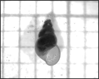
| Potamopyrgus antipodarum (Water snail) | P | ||
| Erpobdella testacea (Leech) | P | ||
| Gammarus pulex (Freshwater ‘shrimp’) | P | P | P |
| Baetis rhodani (Mayfly nymph) | P | ||
| Poycentropus kingi (Caddis larva) | P | ||
| Unidentified Dixidae (Meniscus midge larva) | P |
Key features for identification:



The presence of P. felina in the stream is of note. It is generally recognised as stenothermal species (surviving only in a narrow temperature range). It is suggested that water from the ground spring which supplies the stream has a limited temperature range.
Notes on the Spring
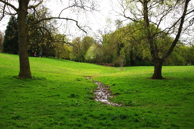
The site identified as the spring on 11th April was again examined on 18th April. It is suggested that the ‘spring’ is a fractured pipe that originally carried water from the true spring further into the park. North of the investigated ‘spring’ is a shallow depression in the land surface, the upper part of which is very wet. It seems likely that this flow is from the true spring.


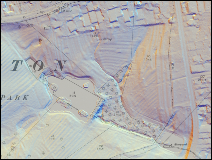
Support for this view can be observed by examining the adjacent map showing a modern LIDAR image superimposed on a 6 inch 1888-1913 OS map. The spring feeding the eastern stream is marked on the OS map and is shown close to the northern park fence. The position of the investigated ‘spring’ can be made out on an enlargement, but the depression begins at roughly the same level as the marked spring. It seems likely that both springs are close to the park fence.
This map shows the geology of the area superimposed on a hybrid base map. The pink area shows bedrock consisting of the Northampton Sand Formation, a known aquifer. The green area shows bedrock of the Whitby Mudstone Formation, which has low permeability. The hand shaped pattern of the mudstone clearly reflects the pattern of drainage in the park. The tips of the ‘fingers’ of the hand are, or are close to, locations where springs may occur. Again, it appears that the spring supplying water to the eastern stream is close to the park’s northern border.

Ground water dissolves much more carbon dioxide from soil than it holds in equilibrium with the atmosphere. This forms carbonic acid which can dissolve carbonates in the soil and rock. When ground water emerges from a spring and comes into contact with air, the equilibrium with the air is restored and carbonate is precipitated. In areas rich in carbonate rocks thick layers of tufa can be formed. The area near the fractured pipe contains nodules which, when treated with acid, gives of bubbles, indicative of carbonate. Even though the examined ‘spring’ may not be a true spring, it delivers spring water. The Northampton Sand Formation is mainly made up of sandstone, but it does contain mudstone and limestone. The British Geological Survey refers to tufa ‘precipitated from calcium carbonate-rich spring waters issuing at or near the base of outcrops of the Northampton Sand’. (Herbert, Barron, Reeves and Smith, 2005, Geology of the Kettering district, a brief explanation of the geological map Sheet 171 Kettering, https://webapps.bgs.ac.uk/Memoirs/docs/B06105.html)

Notes on the Stream through the Upper Spinney
The course of the eastern stream through the upper spinney was followed to its confluence with the western stream. The possibility of creating an excavated pond where the two streams joined was discussed. Although at the time I considered the creation of a pond to be a positive suggestion, I have come to have serious misgivings about the suggestion.
The confluence of the two streams is surrounded by trees and bushes. A pond in that location would be heavily shaded by vegetation. It would also receive a high input of leaves in autumn. The decay of leaves would consume oxygen, and shading would reduce the growth of submerged aquatic vegetation which would help to oxygenate water in the pond. It also seems likely that the vegetation would reduce air movement over the pond and this would, in turn, reduce water movement and the distribution of any dissolved oxygen throughout the pond. The pond is likely to end up similar to many small woodland ponds with a considerable amount of allochthonous (imported) organic material, little primary production (by aquatic plants and algae) other than by emergent and floating flora, and oxygen deficient conditions. The aquatic fauna is likely to be very restricted although not without interest.
A deep pond might have value for terrestrial and amphibious species, but it would silt up rapidly and require frequent dredging. It may be more efficient to have minor dams along the stream that would hold back water and create shallow flooded areas within the spinney. Being shallow would allow better penetration of oxygen throughout the water and a greater variety of habitats. It seems likely that dams could be created, moved and recreated more easily than excavation and dredging. This really means doing the work of beavers if such were present to do it naturally!
An alternative would be to create an excavated pond and manage the vegetation around the pond to permit greater light penetration and a reduction in leaf fall into the pond. This would involve removing many of the bushes and self-seeded trees. Online information published by the Royal Forestry Society (https://rfs.org.uk/wp-content/uploads/2021/05/6-Biodiversity.pdf) and the Freshwater Habitats Trust (https://content.freshwaterhabitats.org.uk/2013/09/WOODLAND.pdf) describe the importance of woodland ponds and give information about the construction and management of woodland ponds. However, the former warns about creating ponds in areas that are valuable in other ways. “Don’t be tempted to just create ponds in existing wet areas as these are important habitats in their own right” and the latter warns about creating ponds in sensitive areas.
Recommendations
The above comments are intended to be a starting point for discussion.
However, it is suggested that the springs should receive a more thorough physical and biological investigation. It would be sensible to examine the chemical composition of the water and compile a record of spring water temperatures compared to air temperatures. A through investigation of the aquatic fauna should be obtained over several months.
Much the same applies to the streams flowing through the upper spinney. The fauna should be examined at a number of sites over a period of time, preferably a year. The terrestrial fauna of the spinney should also be studied.
The possibility of creating an excavated pond or a number of flooded areas requires discussion by several people with different interests based on findings from the investigations.
To aid discussions and report writing, it would help if an agreed nomenclature for the various springs and streams in the park could be agreed and mapped.